
3D laser scanning is a method of collecting extremely fine and correct information about a construction area using laser rays. A laser beam assesses the structure’s numerous dimensions, including the length, width, and height of the construction elements, and also their connections to each other.
The point cloud image created by the 3D laser scanner precisely copies the scanned objects. Based on the make and type of the 3D scanner, it could be used up to a distance of many meters. The information obtained can subsequently be utilized to construct 2D CAD drawings or 3D Revit BIM models using Building Information Modeling (BIM) and Computer-Aided Drawing (CAD) tools.
3D laser scanning has many benefits in the field of construction. We can acquire data quickly using 3D laser scanning. Drones are mostly used to scan point clouds and convert them to BIM. Slam scanners are frequently employed with this unmanned aerial system.
Easy-to-deploy pedestal for mapping and surveying with drones from the air. Drones, on the other hand, have been outlawed in many countries for security reasons. The drone, on the other hand, provides us with vital 3D laser scans for the BIM process.
LIDAR and photogrammetry are 2 of the most prevalent forms of 3D scanning techniques:
A LIDAR scanner comprises a high-powered laser traveling horizontally and a mirror spinning on a vertical axis, and is commonly used in architecture and construction. The laser covers a large region in this manner, scanning hundreds of dots per second. Laser scanning also necessitates a powerful computer capable of storing and processing enormous volumes of data.
Photogrammetry is a technique for creating 3D models from a large number of photographs of an object of interest.
Can you 3D scan a building?
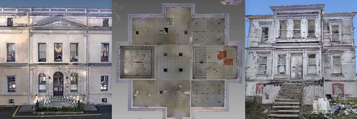
Large-scale models of constructions, such as buildings, are occasionally necessary for many reasons, including repair, documentation, and archaeological research. You could get a model of the structure in one of two ways: measure each dimension or 3D scan the entire structure. For most circumstances, scanning a structure is more simple than measuring every window, door, and wall.
Such building scanning techniques have no bounds with the correct equipment. Some lasers can scan an area with a radius of up to 350 meters (about 1150 feet) in a single pass. These laser devices can even be put on a drone and used to scan high-rise buildings and structures.
Photogrammetry, on the other hand, is mostly dependent on the amount and quality of photographs taken. However, while utilizing photogrammetry, it’s preferable to avoid sunny days because reflections may easily mislead the software. Drones can assist in this situation by taking images of difficult-to-reach locations.
At Solvotek, we provide 3D Scanning and Scan-to-BIM services for Architecture, Construction, Industrial and Marine Sectors. We welcome you to contact us for more information about any of our products or services.